Please DO NOT use our postal address in a SAT-NAV – there is no Postcode for the site! The nearest dwelling with a postcode is PL8 2NL.
From Plymouth: take the A379 towards Kingsbridge. After leaving Plymouth and entering the South Hams, you will go through Brixton village. Carry on through to the other side of Brixton and about a mile further you see a sign for ‘Woodland Burial Ground’. Turn right here (on the road, not into the first driveway which is the Kitley Hotel driveway). Go down into the dip and over the little bridge and up the other side of the hill. On the way up the hill you go through woodland, then the road has a sharp left bend. 400 metres after that bend, you will see another sign on the left indicating the entrance to the Woodland Burial Ground.
From Exeter: take the M5 then the A38 towards Plymouth. Do not take the turning off the A38 signposted for Ermington, Modbury and Yealmpton. Drive on for 6 miles and take the turning signposted Smithaleigh, Yealmpton and Services. As you turn off the A38 here, go past the petrol station. Stop as a road joins from the right. Then turn left leaving The Smithaleigh Hotel on your right. Follow this lane to the village of Yealmpton (2 miles) then take A379 towards Plymouth through the village and out the other side. You will see a sign for ‘Woodland Burial Ground’. Turn left and follow the directions above.
Access: You may visit at any time but please respect any burial in progress. The small pedestrian gate is not locked but, if you want to drive into the site, you will need to use the code for the vehicle gate lock which is given to all Members or relatives at the time of joining. Ring 07739 806898 if you have forgotten it.
Finding Graves: Grave plots are arranged in Groves and to locate a particular grave you need to know the Grove and Plot Number. This information can be found on our Interment Certificates but, if you do not have a certificate, please contact us as we do not publish the burials register online for confidentiality reasons. To assist you in locating a grave, you will find a chart, similar to that shown here, at Plot 1 of each Grove. 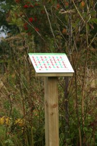
You can also download the appropriate chart from the list below. All charts have the western boundary of the burial ground, which is the adjacent road, at the bottom. If you are not sure where the Grove is, refer to the Burial Ground Map. Memorial plaques are the definitive way to identify a grave but if none has been placed you will need to use the chart and count along the rows and columns. Remember that some plots remain unused; these are reserved by members and shown green on our charts.
We do not record where cremated remains (ashes) are buried but some burials are marked by memorial plaques.
Grove A
Grove B
Grove C
Grove CC
Grove D
Grove E
Grove F
Grove G


 If you want to reserve adjacent plots for family members, you will need to complete a